Himalayan Blackberries: Maybe they are good for something?

By Ken Bevis, Stewardship Wildlife Biologist, Washington State Department of Natural Resources, ken.bevis@dnr.wa.gov

Iconoclast: pronoun. One who challenges conventional thinking in a manner causing logical confusion and sometimes a reconsidering of established views. A person who attacks cherished beliefs or institutions. (Wikipedia) I want to be one here.

Rubus armenaicus is native to the region of Armenia and northern Iran (located between the Black and Caspian Seas, near Turkey and Russia). It was introduced to Germany in 1835 as a crop plant. Brought to the United States in 1885 by Luther Burbank himself, one of the greats in horticultural history. Somewhere during this phase of crop promotion, the (incorrect) moniker of “Himalayan Blackberry” (HBB) was applied. It was first planted in the U.S. near Santa Rosa California and then to other locations in the Northwest. Apparently never hybridized, it was promoted as vigorous, with heavy berry yields. (True!) The plant escaped propagation and quickly spread. It is now naturalized and considered a noxious weed (as we well know) in many areas, including western Washington.

 Nearly impenetrable HBB thicket. (Ken Bevis, DNR)

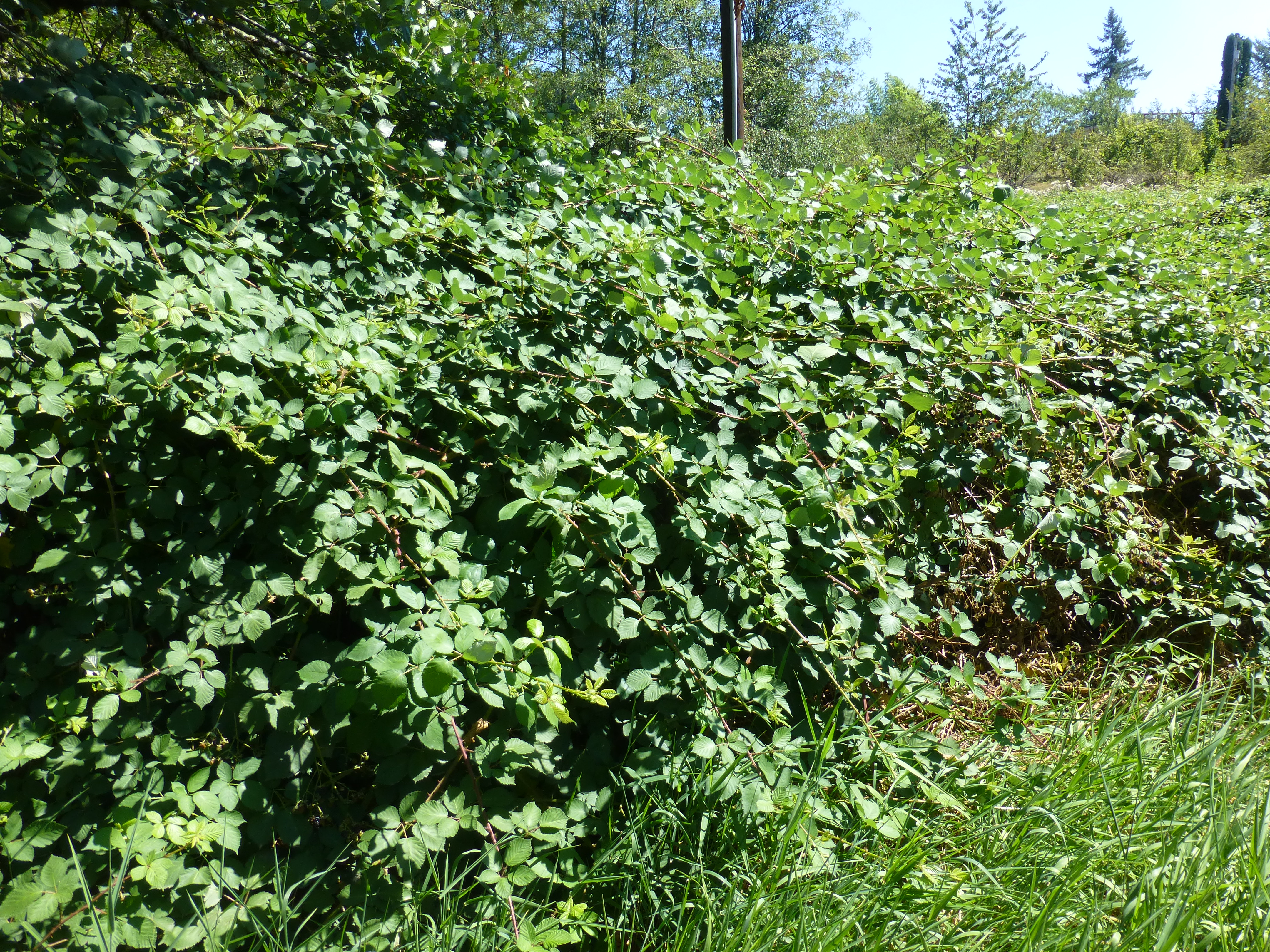
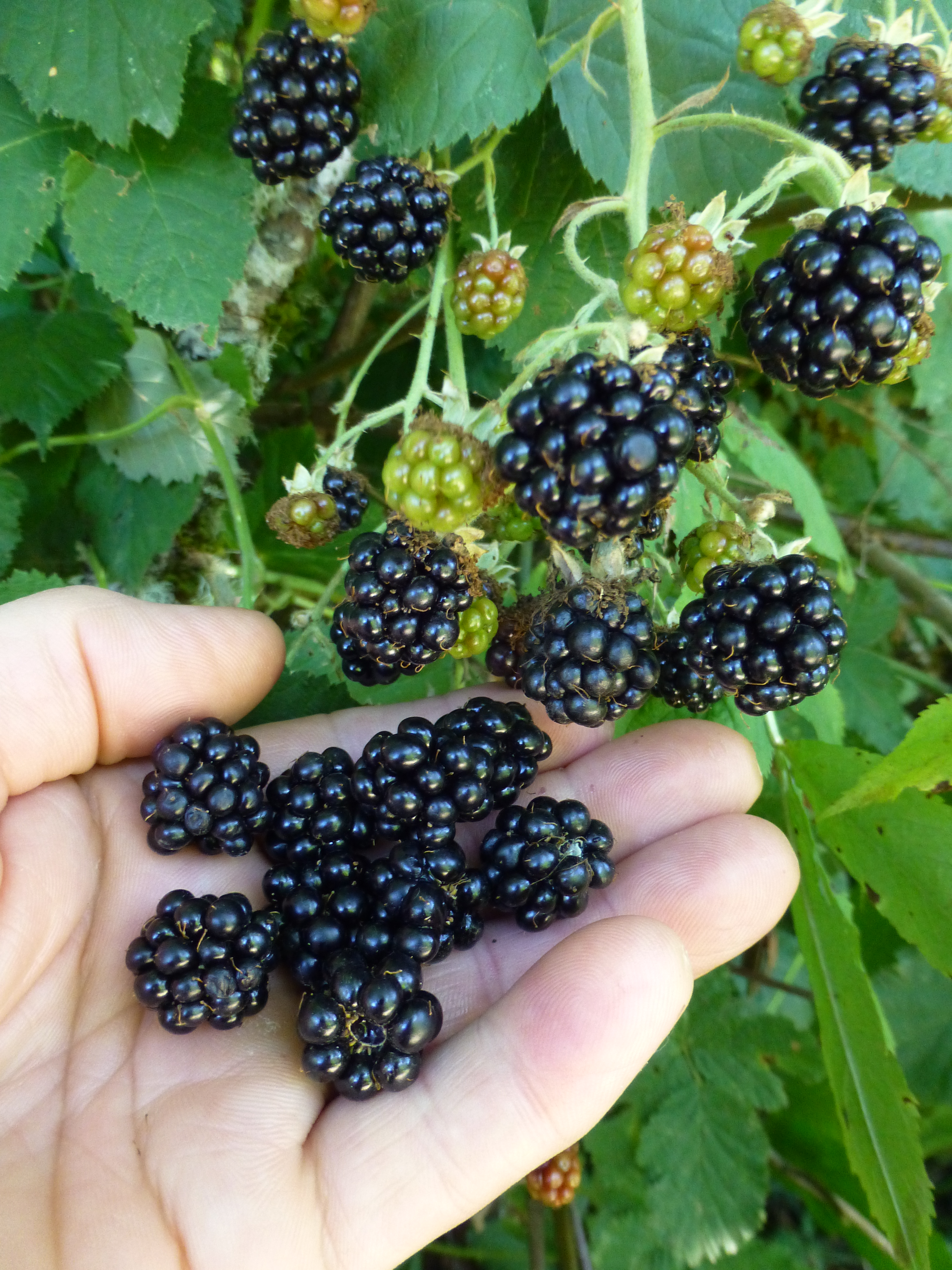
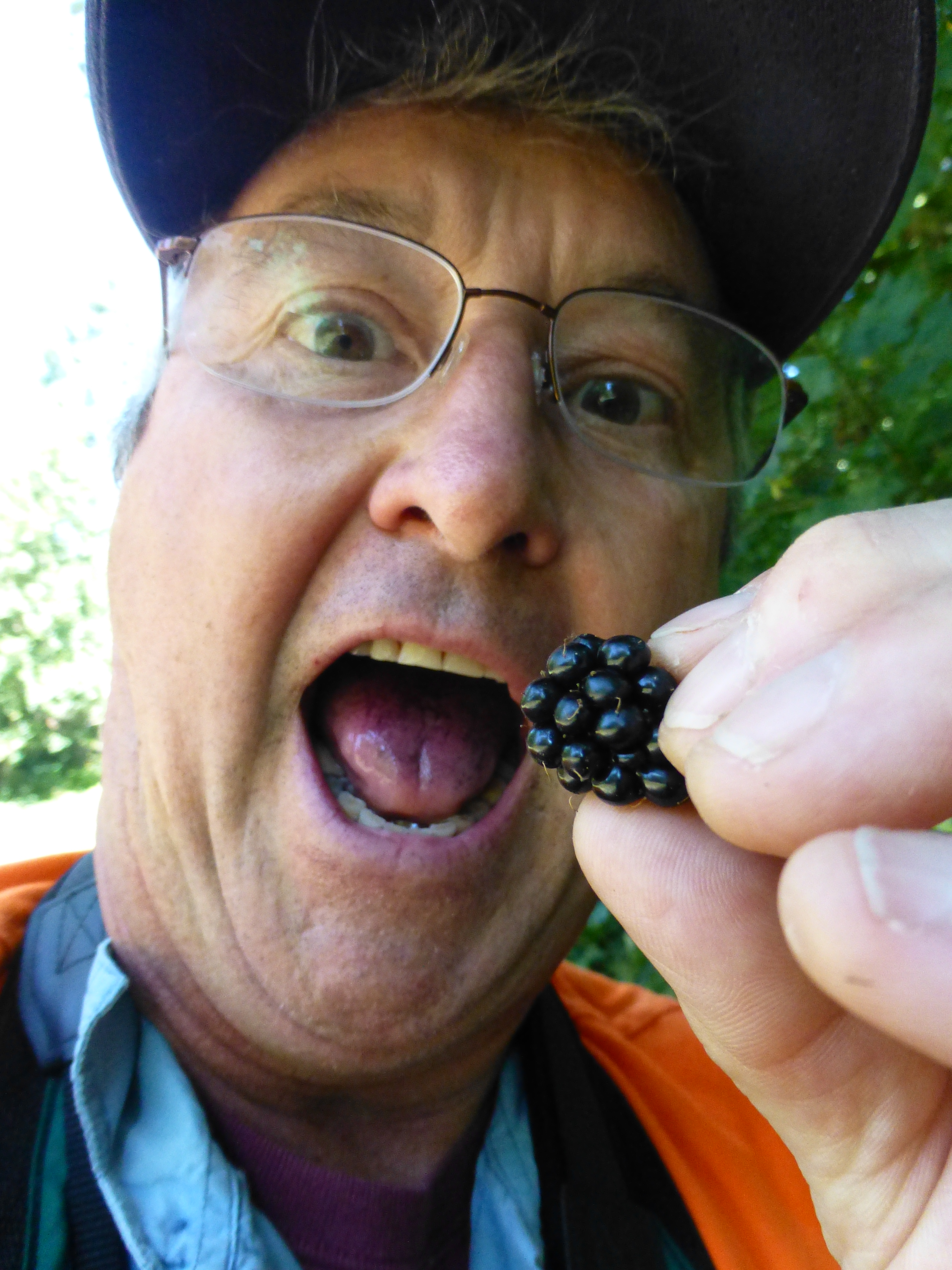
Himalayan Blackberries: One of the most aggressive and challenging introduced plant species that have established themselves widely on small forest ownerships. HBB outcompete desirable native plants, taking up growing space intended for trees, overrun trails and open forest stands, and generally are a nuisance. Dense thickets are impenetrable due to the strong canes and vicious spines. Ouch! And they are challenging to control. HBB, however, are the only noxious weed I can think of that provides tangible human benefit in the form of jam, cobblers and pies (and I hear wine too). The plant even has a fan base. (The “Himalayan” Blackberry, a California Summer Tradition – Bay Nature)

Food. Water. Cover. The wildlife mantra. When these three things exist in a home range for any species, they have a chance to succeed, i.e. survive and reproduce. How many times have we seen a song sparrow, or a junco, or robin sitting atop an HBB thicket? Or a rabbit scooting underneath? How many bears or birds eat the berries? How many of us have enjoyed the sweet fruits? HBBs can provide cover, and food in abundance.

Let’s face it. They are here to stay. Our “natural” environment, especially in the developed “front country” is a crazy mishmash of both native and introduced species. This topsy-turvy world is an ever-moving kaleidoscope of success and failure, right in front of our eyes. Let’s pop some bubbles: there is no “balance of nature.” The natural world is a seething cauldron of organisms pushing, shoving, cooperating, and surviving (or not), all around us, and they don’t care where they came from (ask a starling if he/she remembers England). Some places have a semblance of stability, especially in relatively undisturbed environments (arguably “balance”), but most of the world now, is “disturbed” and dominated by humans and human influences, such as introduced organisms. Hence, the importance of active management to help us achieve objectives.

So, back to HBB.

Ripe, sweet HBBs. (Ken Bevis, DNR)

They were introduced as a high productivity agricultural plant that grew fast and produced lots of tasty berries. Good objectives, but then, oops. They escaped and now are widespread, and a real pest.

Our Service Foresters, and virtually all land managers in lower elevations of Washington, continuously battle numerous invasive and noxious plants. We have a detailed set of programs with Noxious weed lists and categories, with even legal requirements to control certain species (Class 1). Others have become so ubiquitous (Class 3) that they are basically considered part of the landscape now; HBB is one of these.

Don’t get me wrong, I am not advocating for letting HBB take over the landscape. However, this is one of our “bad” plants that may have some redeeming value as habitat. Many birds and mammals eat the abundant berries (and yes, spread the seed far and wide). The thickets offer amazing cover for many creatures, including birds and mammals.

I heard a story from a landowner in Clark County about a huge HBB thicket on her property. There was a tunnel going into the jungle, big enough for her to crawl into it. She did. Some distance under the viney roof, was a chamber, almost big enough for her to sit up in. What? A bear den? On the far side of the cave, she spotted something in the faint light; it was a porcupine! And how many HBB thickets have low trails going into the vines? Places for rabbits, raccoons, skunks or other medium or small mammals to take refuge? Or locations for birds to nest in the vines or on the ground underneath?

I advocate for habitat piles to create cover thickets for wildlife, and have observed that in western Washington, these will often become HBB thickets with a pile in the middle, providing cover in abundance. And once this happens, it is nearly impossible to control these HBB without destroying the habitat feature.

 The author participates in assessment of the situation regarding HBB. (Ken Bevis, DNR)

That said, HBB must be controlled in most circumstances, otherwise many sites will only have this remarkably aggressive plant, thus reducing plant diversity, overall habitat quality and diminishing ecological integrity. There is plenty of information out there about management, including this succinct resource from King County: King County Best Management Practices for Himalayan and Evergreen Blackberry (Rubus bifrons and Rubus laciniatus).

Basically, HBB is bad. It takes over. However, all things in small doses, right? If we recognize that a thicket, or hedgerow, of HBB has some value, and we make sure it doesn’t spread, it can function as a valuable habitat feature, and a place for tasty berries to be harvested. Decide where it is ok to have it. Mow the perimeter regularly. Maybe dig up root crowns. Keep it right there with active management. Where you don’t want it, work to eradicate. Use the tools you need to win!

Good news: HBB has some habitat value. The bad news: it grows too darn much. And to those weed warriors out there, keep up the good work!

Get to Know More New Faces at the Small Forest Landowner Office

The Small Forest Landowner Regulation Assistance Program recently welcomed a new Regulation Assistance Forester to the team. Allow us to introduce John Schmeltz, who is based in and serving small forest landowners in the Olympic peninsula area.

Tell us a little about yourself.

I enjoy being outside in nature. This includes just getting out and doing things like camping, hiking, riding bikes, just relaxing, or fishing and hunting. For me, knowing where my food comes from is important, and so I have a small little hobby farm. We raise all our own meat including beef, pork, and chicken. Also, we grow a large garden and we can a lot of produce so that it can be enjoyed year around.

Describe your job.

In my job I get to help people understand forestry as well as our state’s forest practices rules. As far as forestry goes, we look at what the current forest condition and management situation is and discuss options to employ to get to desired conditions. For example, if small forest landowners choose to conduct a timber harvest, I can help guide them through the forest practices application permitting process.

Why do you think our work is important?

I feel that my work is important because I get to help people who may not understand everything involved in conducting forest practices. The forest is a very dynamic environment and knowing how to meet your future desired conditions can be challenging and so it is important to be able to provide informed management guidance on possible things landowners can do.

What kind of legacy do you want to leave behind?

I would like to help people understand nature and hopefully get a passion for it.  I would like them to realize that nature has a big impact on people and that it needs to be managed in different ways so that it can be multifunctional.

What is your favorite kind of tree and why?

My favorite tree would be the redwood. This is because they are such a large and majestic tree.  Also, the fact that they can create little micro-environments of plants in their canopy is really interesting.

Do you care for your woods?

By Dave New, Past Chair of the Washington Tree Farm Program, info@watreefarm.org

(Credit: Bob Obedzinski, Nancy Romanovsky, Tammie Perreault, and Corie Lopardi, Washington Tree Farm Program)

You own a piece of forest land in the Evergreen State, and you have a forest management plan. Are you ready to take the next step? Become one of the 1,400 land stewards in our state with an American Tree Farm System certification in the Washington Tree Farm Program for your family’s forest.

Tree farming began right here in Washington State in 1941, when the Weyerhaeuser Company dedicated the Clemens Tree Farm near Rochester to sustainable and renewable forestry. It evolved into the American Tree Farm System (ATFS), a nationwide certification program for small forest landowners who privately own between 10 and 10,000 acres of forestland. The ATFS certification is recognized by the Programme for the Endorsement of Forest Certification, an international body.

The Washington Tree Farm Program (WTFP) is a 501c3 non-profit organization dedicated to promoting and assisting small forest landowners in our state, to be better stewards of the land. The voluntary certification program ensures healthy privately-owned forestlands contribute to our state’s clean water, wildlife habitat, and recreational opportunities, while producing the jobs, wood, and timber products we all need. 

WTFP has over 100 professional foresters who are trained to work with landowners to inspect and certify that their forests meet the standards of the ATFS system. Some of our inspectors are private foresters, some work for the Washington State DNR, others work for the US Forest Service, local conservation districts, or teach forestry.  All are a part of WTFP to help landowners do right by their land.

If you are committed to tending your woods for good forest health, you are one of us.  If you want to provide good habitat for wildlife, you are one of us.  If you want to protect the lakes and streams on your property and provide good aquatic habitat, you are one of us.  If you want to provide recreational opportunities, you are one of us. If you want to create or continue a legacy that can be passed down to future generations, you are one of us.

Visit our website. Contact us. We will arrange to have one of our forester inspectors walk through your woods with you. They will be able to answer your forest management questions, help you better prepare for the future, and assist you in obtaining ATFS certification. Perhaps you have questions about invasive species, or root rot in a Douglas fir stand, or who you should contact for assistance with thinning or harvesting. WTFP does not charge for these visits, nor for certification, nor are there any dues to be paid. And then in five years, when it is time for a reinspection, one of them will walk through your woods with you again.

We recognize that we all have different visions for our own forest lands, and that our management methods and objectives are not the same. We all, however, want to be the best stewards that we can for our land. Join us, become a part of the ATFS network, put a green “Certified Family Forest” sign in front of your land, and stand behind it with pride.

Dave New is the Past Chair of the Washington Tree Farm Program, and a proud steward of Nourse Tree Farm in Snohomish County.

Photos by Bob Obedzinski, Nancy Romanovsky, Tammie Perreault, and Corie Lopardi, all courtesy of Washington Tree Farm Program.

Forest Practices Compliance Monitoring Program: What is it?

By Kelly Childers, Compliance Monitoring Field Coordinator, Washington State Department of Natural Resources, kelly.childers@dnr.wa.gov

Author Kelly Childers is seen recording data on a forest practices compliance monitoring site visit. (Kelly Childers, DNR)

The Washington State Department of Natural Resources (DNR) Compliance Monitoring Program was first established in the 1999 Forest and Fish Law, which proposed increasing measures to protect water quality and riparian-dependent species on private and state forestlands in Washington, based on the best available science.

The Compliance Monitoring Program (CMP) was created to help answer the question: Are forest practices being conducted in compliance with the rules?

The goal of CMP is to collect and report data on statewide Forest Practices Rule compliance rates, and monitor compliance trends over time. Sample sites are randomly selected from completed applications and field reviewed in collaboration with representatives from partner agencies such as Department of Ecology, tribes, and region DNR staff. Information is collected in the field based on the type of resource and proposed activity submitted in the Forest Practices Application. Data are analyzed each biennium, and results are then reported to the Forest Practices Board and released to the public.

CMP collaborates with landowners to perform interdisciplinary field visits to collect data. (Kelly Childers, DNR)

Findings are used to help us understand areas where DNR can improve education, training, or guidance to help landowners manage their forestland while simultaneously protecting public resources for us all. This can lead to development of trainings, suggestions for rule or form changes, or specific outreach efforts.

My forest practices application was selected for review: now what?

CMP staff collect field data at randomly selected harvest sites across the state, around riparian areas, wetlands, and forest roads (Kelly Childers, DNR)

No need to fear! Compliance Monitoring is not an enforcement program. We select specific prescriptions to review for each FPA selected, so you know in advance where we need to go and what we’ll be looking at. Landowners are always welcome and encouraged to attend. Landowner information is not reported or recorded as part of the data collection process. Field reviews typically consist of two to eight people, with some prescriptions requiring participants stationed at different distances from a resource for measuring buffer widths and leave trees.

Activities may include taking distance measurements, counting and measuring leave trees, and looking for stumps of harvested trees within designated no-cut zones. Field reviews are a great opportunity to practice or improve your knowledge of the Forest Practices Rules and to learn more about how the Forest Practices Rules and Board manual guidance inform different management strategies on the ground.

Compliance Monitoring Data Trends Suggest Good Compliance Rates

The CMP publishes a statistical study of post-harvest evaluations every two years. (Kelly Childers, DNR)

The Compliance Monitoring Program serves as a tool for understanding the rate of compliance of forest practices activities in our Washington forests with the Forest Practices rules  portion of the Washington Administrative Code. We explore trends in compliance rates between small and large forest landowners in every region of the state, working closely with Tribal Nations, DNR, Department of Fish and Wildlife and Department of Ecology staff. The Compliance Monitoring Program examines compliance rates as the total number of rules that were followed accurately divided by the total number of rules assessed for all site visits across the state. CMP staff typically review about 200 samples over the course of the biennium.

Overall, statewide compliance rates for most prescriptions sampled (during the 2020-21 biennium) were above 90 percent. The only exception being non-forested wetlands, which was still relatively high, at 88 percent compliance. This means, most of the time, Forest Practices rules are followed correctly for reviewed prescription types, and resource protections are generally applied adequately in Washington state.

Compliance Monitoring DNR Webpage Updates and StoryMap

Our webpage on the main DNR website Compliance Monitoring | WA – DNR has more information on our program, including an ArcGIS StoryMap. This is a great place to find out more about CMP prior to our upcoming field season. CMP reports are hosted on this page, including our most recent 2020-2021 Biennial Report.

Contact Information

CMP Manager: Mary Murdock – Mary.Murdock@dnr.wa.gov

CMP Field Coordinator: Kelly Childers – Kelly.Childers@dnr.wa.gov

CMP Email: DNRRECOMO@dnr.wa.gov

Assisted Migration Options and Considerations

By Anne Favolise, Service Forester, Washington Department of Natural Resources, Anne.Favolise@dnr.wa.gov

 A grove of redwoods at Hama Hama Tree Farm, near Lilliwaup, Washington (Holly Haley, DNR)

Landowners routinely ask DNR Service Foresters about assisted migration, which is human-assisted movement of a species of tree. Here in western Washington, those conversations usually revolve around planting coast redwood trees in response to other native trees struggling due to the stress of dry and hot weather events that we have experienced the last few years. A common concern with assisted migration, however, is whether a species that is not native to an area will become a hinderance to native plant and animal species.

Will an introduced species change the ecology of an area and will this new kid on the block harbor pestilence?

Questions about ecological suitability are important ones and usually lead to a dialogue where alternatives to planting redwoods are discussed, such as planting a tree that is native to an area, but sourced from nearby seed zones where that species has adapted to live in a drier and hotter environment.

Planting a tree species outside its historic range and planting a tree species sourced from a seed zone within its historical range are both forms of assisted migration. There is a third type of assisted migration as well, where species are moved just beyond their historic range.

Here are how the three types of assisted migration are defined on the USDA’s Forest Service website:

  • Assisted population migration (also assisted genetic migration or assisted gene flow) – moving seed sources or populations to new locations within the historical species range.
  • Assisted range expansion – moving seed sources or populations from their current range to suitable areas just beyond the historical species range, facilitating or mimicking natural dispersal.
  • Assisted species migration (also species rescue, managed relocation, or assisted long-distance migration) – moving seed sources or populations to a location far outside the historical species range, beyond locations accessible by natural dispersal.

Some examples of each type of assisted migration:

  • Assisted population migration would be planting Douglas-fir or Western redcedar in Sequim, Washington that came from a nursery two seed zones east of Sequim. In this case, the Douglas-fir and Western redcedar are being planted where other populations of these species exist in their native range.
  • Assisted range expansion would be planting Coast redwood from Northern California in Coos County, Oregon, which is just north of the native range of Coast redwood.
  • Assisted species migration would be planting Coast redwood from Northern California in southeast Alaska which is far outside the historical species range, beyond locations the seeds would naturally be dispersed by animal, wind, or water.

Considering the long-term impacts assisted migration might have on the environment is important when coming up with management options for your forestland, especially if you are interested in assisted species migration. Arguments have been made regarding risks associated with human interference in species distribution. There are many cases of introduced species going wild, growing out of control, and outcompeting native vegetation.

Himalayan Blackberry (Rubus armeniacus), Scotch Broom (Cytisus scoparius), and English Holly (Ilex aquifolium) are all species that were intentionally brought to North America over a century ago. All three are now considered some of the most noxious, invasive weeds in Washington. They can seriously impact local fauna, soil hydrology, important fungal communities, and other parts of the ecosystem in ways we don’t fully understand yet.

The lower-risk options of assisted migration are assisted range expansion and assisted population migration, as these population shifts have less potential to change the natural ecological functions of an area. One approach to using assisted migration as part of your forest management is to implement small scale projects and projects that include planting only a fraction of species which are not native to an area.

This graphic demonstrates each type of assisted migration using the darker green conifers as the example; the three types of assisted migration are applicable to all plants. Different populations are represented by individual gray areas. Orange arrows represent human-assisted movement of plant material from the dark green conifers to new locations. (Graphic and description courtesy of USDA/USFS)

There is still a lot to learn about assisted migration. Deciding on seed sources, the current and projected climate of an area, soil conditions, how well a tree might become established, the regional ecology, and the local economy are just some of the things one should carefully consider when implementing an assisted migration project. Project scale is an important factor, too. For example, planting a handful of coast redwood trees in your front lawn in western Washington for shade and aesthetics will not make as big an impact on the environment, compared to planting hundreds or thousands of coast redwoods for reforestation or timber production. As we move forward with the discussion of assisted migration, may we be considerate and strive to learn more.

Works cited:

  1. Handler, S.; Pike, C.; St. Clair, B.; 2018. Assisted Migration. USDA Forest Service Climate Change Resource Center. https://www.fs.usda.gov/ccrc/topics/assisted-migration
  2. Climate-Woodlands, 2019. The Debate about Assisted Migration. https://climate-woodlands.extension.org/the-debate-about-assisted-migration/

Our Amazing Little ‘Kermit:’ the Pacific Tree (or Chorus) Frog

ChorusFrogSanJuan08

ChorusFrogSanJuan08
San Juan island dark phase Pacific tree frog (Ken Bevis, DNR)

Nordstrom.GreenFrog
Pacific Tree Frog. (Photo by Noelle Nordstrom)

By Ken Bevis, Stewardship Wildlife Biologist, Washington State Department of Natural Resources, ken.bevis@dnr.wa.gov and Dr. Corey Straub, Associate professor of Biology, Ursinus College, cstraub@ursinus.ed.

It is early spring, and in many fortunate places near ponds, puddles and wetlands across Washington, voices of our small native frog ring all around. The song is both joyous and sometimes deafening! It is a crisp, “ribbit,” with many joining into the occasionally synchronized chorus. In spring, male Pseudacris regilla, inflate sacs on their lower jaw, and sing to attract mates around the edges of open water. They defend their tiny singing territories (about 30 square inches according to one study) and hush when a prospective female arrives. They then quietly mate. Eggs are laid in water and attached to or under vegetation. This remarkable critter is the most widespread frog in the Pacific Northwest, occurring across many habitats and elevations. They are a very adaptable amphibian.

FrogEggs3
Amphibian egg mass from shallow pond. (Ken Bevis, DNR)

They are small — with adults measuring only 2 or 3 inches in length, and a formidable almost 1 inch tall. They can tolerate a wide range of conditions, including dry forests, and travel to upland sites when not breeding. Tree frogs, like all frogs, undergo the miracle of metamorphosis, whereby the herbivorous, swimming tadpole, changes into a carnivorous, legged predatory adult frog. They can live five or more years!

These little critters are voracious predators too, eating a wide variety of insects and various invertebrates (including slugs), usually swallowing their prey whole. They capture prey using their long flashing, sticky tongue and quick strong jaws. They are also prey for a wide variety of predators, including garter snakes, kingfishers, great blue herons and even some owls.

Recognizable by the distinctive black eye stripe, they come in a variety of colors, but mostly either brown gray, or green (sometimes a strikingly bright green!). I heard these frogs change color to match their environment, so I reached out to my friend, Dr. Corey Straub, who studied them for his Master’s Thesis, and asked. He sent me this wonderful short essay answering the question: Do Pacific tree frogs change color? And how?


“Pacific Tree Frog Coloration”

By Dr. Corey Straub

One of the more interesting features of Pacific tree frogs is their body color. In a single population, green, brown, and gray frogs often coexist. In rare cases, reddish and even blue frogs have been observed. Species with color polymorphisms (poly = multiple, morph = form) raise lots of interesting questions for biologists. What is the function of body color? Why does it vary among individuals? Can individuals change their body color?

Body color can serve multiple functions, but the one that has received the most attention in Pacific tree frogs is protection from predators. Cryptically colored (or camouflaged) frogs are harder to see, and studies have shown that Pacific tree frogs are less likely to be eaten by snakes and birds when they are resting on a background that matches their body color. In nature, green, brown and gray backgrounds are provided by leaves, soil and tree bark. While all three colors can be found in the same habitat, seasonal changes in the amount of green vegetation are a regular feature of the frogs’ environment. The frogs emerge from their overwintering refuges to find a largely gray and brown world that becomes increasingly green as spring unfolds into summer. Researchers have observed that the relative abundance of green color morphs increases with the abundance of green vegetation, and vice versa. Thus, hungry predators and variation in environmental color (across space and time) appear to work together to favor color polymorphism in the Pacific tree frog.

Interestingly, the Pacific tree frog has two different strategies for blending in. Some frogs change their body color, while others are careful about where they rest. Color-changers will turn green (or stay that way) in response to brighter environments, perhaps because bright light and green leaves are associated in nature. The change from one color morph to another takes days-to-weeks (a rate that true chameleons would consider laughable) and only some individuals are capable of it. Non-changing green and brown frogs appear to compensate for their stubborn skin by choosing the right place to rest. These frogs select backgrounds that match their body color when given a choice, an adaptive behavior that their color-changing counterparts seem to lack.


wetlandhabitatfrogs
Pacific tree frog breeding habitat. Western WA near Chehalis. (Ken Bevis/DNR)

We find tree frogs under the barbeque cover and in potted plants on our porch in the dry Methow Valley every year! Where do they winter? According to the Deschutes Land Trust, they “seek out deep cracks and crevices in logs or rocks, or burrow as deep as they can in leaf litter” to hibernate. And they will move long distances to find good habitats.

According to one source, Pacific tree frogs were one of the only vertebrate species to survive in the Mt. Saint Helen’s blast zone!

Numbers of amphibians globally are declining and of great concern. However, our little frog seems to be doing okay, and we get to enjoy their singing and delightful presence on our small forest lands! What a cool little critter. Appreciate the next one you meet.

Send me a photo of your favorite tree frog.

References:

Morey, S. R. 1990.  Microhabitat selection and predation in the Pacific treefrog, Pseudacris regillaJournal of Herperptology., 24: 292-296.

Resnick, L. E., and Jameson, D. L.  1963.  Color polymorphism in Pacific tree frogs. Science, 142: 1081-1083.

Straub, C. S. 2001. Environmental color tracking by the pacific chorus frog, Pseudacris regilla (Masters Thesis, Central Washington University).

Tordoff, W.  1980.  Selective predation of gray jays, Perisoreus canadensis, uponboreal chorus frogs, Pseudacris triseriataEvolution, 34: 1004-1008.

Wente, W. H., and Phillips, J. B.  2003.  Fixed green and brown color morphs and a novel color-changing morph of the pacific tree frog Hyla regilla. Am. Nat., 162: 461-473.

Wente, W. H., and Phillips, J. B.  2005a.  Microhabitat selection by the Pacific treefrog, Hyla regilla. Anim. Behav., 70: 279-287.

Wente, W. H., and Phillips, J. B.  2005b.  Seasonal color change in a population of Pacific treefrogs (Pseudacris regilla). J. Herp., 39: 161-165.

Wild Apricot: Web publication. U.S. Fish and Wildlife Service: https://fotr.wildapricot.org/resources/Documents/Education/Pacific%20Tree%20Frog%202-9-19%20FWS%20Approved.pdf

Photopoint Monitoring: A Simple and Effective Tool

Photopoint_example_pre-treatment
The road, Douglas fir, and a GPS point were used to mark this point. This photo was taken pretreatment. (Rachel Mazzacavallo, DNR)

By Rachel Mazzacavallo, DNR Service Forestry Coordinator, Rachel.Mazzacavallo@dnr.wa.gov

Do you monitor your forestland? If you take routine strolls around your property, the answer is yes! Every time you take a walk around your property, your visual observations are part of your own micro-monitoring effort. What if I told you, you are one step away from turning your enjoyable strolls into a valuable management activity? All that is missing is a visual record. Photopoint monitoring is a simple and effective way to use an organized series of photos to capture change over a given period of time. All that you need to do is strategically choose a location- or several, take a photo, file it, and re-measure at the interval that meets your goals. Photopoints can help you make informed management decisions, pass local knowledge to the next stewards, or even settle an argument about, “what was there,” with your spouse. So, as the weather improves and you begin to venture out more, start to consider what location would be a good spot to establish a photopoint. Despite what it can teach us, this type of monitoring is often overlooked in small private forestland, so grab your camera and head to the woods!

Basic steps of photo point monitoring:

  • Select a location

Choose a good vantage point. Some areas that provide good locations for photopoints are along trails, roads, natural openings, on side slopes, and in locations that have no close visual obstructions. Identify a distinct, fixed object, such as a unique tree or a landscape feature, to frame within your photo. This will be used to relocate your point and improve the precision of your re-measurement photos. Mark the location on a map, with a GPS, or on the ground with a monument such as a small metal stake, changing pin, or rebar with flagging. If you do use flagging, use a sharpie to write on the flagging the point number and photo direction.

  • Determine the re-measurement interval

While you do not need to re-measure your points every year, you do want to revisit them often enough that you are capturing the visual changes of your forest over time. If you are planning to implement a management activity, you should plan on measuring the point before implementation and soon after completion.

  • Organize

Do not discount the importance of keeping your files organized. Plan to keep a digital copy or a hard copy. Use whatever storage method is easiest for you to follow through with consistently.

Photopoint_example_post-treatment
This photo was taken post treatment. (Rachel Mazzacavallo, DNR)

Tips for photo storage:

  • Keep them in a file on your computer, preferably in the same folder as your forest management plan. I suggest creating a photopoint folder with subfolders for each year you re-measure the point.
  • Name each picture with the location or a plot number.
  • Keep a plot card with the date, the photopoint number name, and the cardinal direction you are facing or place a placard in the corner of each picture with this information.

And lastly, when you update your forest management plan, add monitoring as one of your management activities!

Forest Health Highlights – an Annual Summary of Insect and Disease Activity in Washington

W_Image_SBD_1
A bigleaf maple tree with sooty bark disease signs (sunken black fungal mats) were sampled as part of the summer 2022 survey. (Photo by Rachel Brooks / DNR)

By Glenn Kohler, Forest Entomologist, and Rachel Brooks, Forest Pathologist, Washington DNR, Glenn.Kohler@dnr.wa.gov, Rachel.Brooks@dnr.wa.gov

Every spring, the Washington Department of Natural Resources and the USDA Forest Service publish a Forest Health Highlights report that summarizes forest health conditions and trends across Washington from the previous year. The 2022 report and previous year’s reports are available on DNR’s Forest Health website.

Information for the report is gathered through annual monitoring projects and special surveys in response to recent forest damage events that are conducted by DNR and the Forest Service. Examples include an annual aerial survey, insect trapping, baiting streams for the pathogen that causes sudden oak death, and installing ground plots to monitor emerging forest health issues, such as emerald ash borer and sooty bark disease of maple. The report also includes information on long-term field research plots, such as evaluation of white pine blister rust resistance in outplanted trees established at sites throughout Washington.

In addition, the report summarizes recent wildfire activity, weather events and drought conditions that may affect forest health, and updates on forest health initiatives such as Washington’s Forest Action Plan. Maps, charts, photos, and brief descriptions make much of the information in the report accessible at a glance. For those who want more detail, it includes links to other resources like maps and data and the contact information of forest health specialists.

Notable forest health condition events in 2022:

Emeraldashborer
An emerald ash borer.

  • The June 2022 detection of emerald ash borer (EAB) in the northwest Oregon city of Forest Grove increases the potential of this serious, non-native, forest insect pest moving into Washington. The small, metallic green, wood-boring beetle attacks and kills true ash trees (Fraxinus species). EAB has killed over 100 million ash trees in eastern North America since its original introduction to Michigan in 2002. Since then, it has spread to 36 states and moved gradually westward. An EAB infestation could devastate the ash component of Washington’s forests, as well as sensitive riparian areas where the native Oregon ash (Fraxinus latifolia) is a keystone species. Infestations of ornamental ash in urban forests will result in very costly removal and replacement.The public is encouraged to report suspected EAB sightings or damage to ash trees. In Washington State, report a sighting at https://invasivespecies.wa.gov/priorityspecies/emerald-ash-borer/
  • Swiss needle cast aerial and ground surveys indicate no consequential change. Aerial observers conducted a Swiss needle cast aerial survey in May 2022, covering 2 million acres along and near the coastline. Approximately 115,000 acres with symptoms were observed. To support the aerial survey, 96 ground locations across the same coastal range of the aerial survey were assessed in spring 2021 and 2022. Additionally, during the same time period, 32 ground plots were surveyed in Whatcom and Skagit counties in an area where monitoring had not occurred before.
  • The fungus Cryptostroma corticale, which causes sooty bark disease of maples in Europe, continues to be detected in Washington. Initially, this fungus was detected mainly around the Seattle area, but now samples have been found as far north as Bellingham, south into Oregon, and as far east as Pullman. These samples have confirmed the presence of corticale mainly on maple trees (Acer spp.), including on bigleaf maple (Acer macrophyllum), our only native canopy maple. A 2022 ground survey of 50 Western Washington properties indicates that C. corticale on bigleaf maple appears well distributed throughout Western Washington.
  • No notable changes regarding Phytophthora ramorum, the causal agent of sudden oak death, were observed in 2022. ramorum is often found in streams associated with commercial plant nursery trade activity, but there has yet to be any indication that the pathogen is leaving the waterways and impacting bordering vegetation. No stream-baiting sampling locations tested positive for Phytophthora ramorum in 2022.
  • The area with mortality caused by pine bark beetles in 2022 was approximately 123,700 acres. Mountain pine beetle damage increased from 53,100 acres in 2021 to approximately 76,800 acres in 2022. The majority of annual pine bark beetle mortality is in lodgepole pine killed by mountain pine beetle, which totaled 66,800 acres in 2022. Surveyors mapped the highest concentrations of mountain pine beetle mortality in lodgepole at high elevation areas of Yakima, Kittitas, Chelan, Okanogan, Ferry, and Pend Oreille counties.
  • Mortality of ponderosa pine due to western pine beetle has increased steadily since 2012 and reached a peak of approximately 44,300 acres in 2022, the highest level since 2006. Recent drought conditions are likely an important driver of these increases. The highest concentrations of western pine beetle-caused mortality were throughout forested areas of Klickitat County and the Yakama Indian Reservation, central Kittitas County, eastern Okanogan County, the Confederated Tribes of the Colville Reservation, throughout Stevens and Spokane counties, and the Blue Mountains in southeast Washington. Mortality attributed to Ips pine engravers was mapped on 2,500 acres in 2022, above the 10-year average of 1,700 acres.
  • Mortality due to Douglas-fir beetle has been increasing in recent years, reaching a 10-year high of approximately 105,000 acres in 2022, well above the 10-year average of 43,000 acres and the highest level recorded since 2001. Fir engraver caused mortality, primarily in grand fir, had been steadily increasing since 2015 and reached a 10-year high of 166,300 acres in 2019. Since then it has declined to approximately 65,700 acres in 2022.
  • Chronic infestations of the non-native balsam woolly adelgid affected approximately 30,000 acres in 2022, accounting for the majority of defoliation damage in Washington. Damage was primarily in subalpine fir at high elevations in the Olympic, Cascade, and Selkirk mountain ranges. No Douglas-fir tussock moth defoliation has been recorded in Eastern Washington since the 2018-2019 outbreaks in Kittitas, Chelan, and Okanogan counties collapsed. No new western spruce budworm defoliation was observed from the air in northeast Washington, where the most recent outbreak is declining.|
  • Some foliar diseases were notable in 2022. Western larch defoliation was mapped on approximately 27,500 acres, an increase from the 3,300 acres mapped in 2021. Of the acres affected, lower crown defoliation due to larch needle cast (Rabdocline laricis) was mapped on approximately 27,300 acres, driving the increase. An outbreak of powdery mildew was observed on bigleaf maple in spring 2022 throughout western Washington. Similar to many foliar diseases, these will likely have minimal long-term impacts to healthy trees.

    B_Fig_Summary1_Total_damage10year_2013-2022_IDedit2.6.23
    Total acres with insect and disease damage in Washington, 2013-2022. *Trend data are not available for 2020 due to changes in survey methods and reduced survey area.

Annual Insect and Disease Aerial Survey:

An annual insect and disease aerial survey conducted by the Forest Service in cooperation with DNR covers the majority of Washington’s 22 million acres of forested lands and provides much of the trend information in the report. Since 1947, aerial observers have reported the location and intensity of damage by forest insects, diseases, and other disturbances across all ownerships of forestland in Washington.

Without aerial surveys, it would be impossible to track disturbance conditions over such a large area using ground-based methods. Aerial surveys are also an important tool used to detect and map new outbreaks of native and exotic insects and diseases. The total area mapped with some type of damage varies each year from a few hundred thousand to nearly two million acres.

AerialSurvey1_flightline_map_2022
This map shows the flight lines of the 2022 Washington Insect and Disease Aerial Survey (USFW, DNR)

2022 Aerial Survey Highlights:

In 2022, surveyors covered approximately 22 million forested acres across Washington. The 2022 season marked the first time survey operations returned to normal since the COVID-19 pandemic, which influenced operation protocols in 2020 and 2021. Approximately 13% of forested acres typically surveyed in the state were not included in 2021 due to fire activity, aircraft availability, and observer availability. No survey flights were conducted in 2020 to lower risk of COVID-19 exposure among flight crews and their contacts. In place of aerial surveys in 2020, the data used for statewide insect and disease surveys were acquired through a combination of ground sampling and remote sensing.

In 2022, the statewide insect and disease survey recorded some level of tree mortality, tree defoliation, or foliar diseases on approximately 672,000 acres. The area with damage from mortality agents was approximately 604,000 acres, including 346,000 acres attributed to bark beetles and 129,000 acres attributed to bear damage or root disease. Approximately 33,000 acres with damage were attributed to defoliators and approximately 35,000 acres were attributed to tree diseases or other damage causes.

It should be noted that disease damage is significantly underrepresented in aerial survey because symptoms are often undetectable from the air.

Maps and Other Aerial Survey Products available to the public:

Whether you are a regular user of aerial survey maps and data or just learning about what’s out there, check out some of the ADS products now available.

  • Downloadable PDF aerial survey quad maps from 2003 to 2022 are available from the US Forest Service, Pacific Northwest Region.
  • Interactive, web-based aerial survey maps are available to explore at: To view, select Forest Health > Annual Aerial Survey Data.
  • The USFS maintains current year aerial survey data and summaries in an interactive, web-based map and a Forest Heath Dashboard. Click on the “Data Viewer” and “Forest Health Dashboard” links to learn more.
  • Washington’s annual Forest Health Highlights report is available online and includes information on how to access downloadable GIS layers.

If you have any questions about these products or need information about forest insects and diseases, please contact the DNR Forest Resilience Division at 360-902-1400 or email: forest_health@dnr.wa.gov.

To see more from Glenn Kohler and Rachel Brooks, visit Washington State University Extension Forestry’s Lunch Break series.

Are You Wildfire Ready? Popular Eastern Washington Wildfire Resilience Program Expands to Westside Counties

2O2A9484
Commissioner of Public Lands Hilary Franz, left, and Congressman Derek Kilmer listen as Guy Gifford, assistant division manager for Community Resilience at the state Department of Natural Resources, speaks about the Wildfire Ready Neighbors program during a press conference on April 4. (Photo by DNR)

By Natalie Johnson, forest practices communication manager, Natalie.johnson@dnr.wa.gov

Since 2021, thousands of Eastern Washington residents have taken steps to make their homes more resilient to wildfire through the Department of Natural Resources’ Wildfire Ready Neighbors program.

But wildfire isn’t just an Eastern Washington issue. Starting this month, Wildfire Ready Neighbors is launching in three Western Washington counties – Pierce, Mason, and Thurston.

That means residents of Western Washington can visit WildfireReady.com to sign up and get their own Wildfire Ready Plan, which provides tips and strategies to make their properties and neighborhoods more resilient to wildfire.

Residents in current WRN counties – including the three new Western Washington counties — can also sign up for Wildfire Ready Home Visits from a trained partner, who can give them personalized plans to better prepare their property for fire. During the six-week launch event for each new county, residents are eligible for a drawing to a local hardware store for a gift card to help them take action on their property.

The program provides this technical assistance by working with local partners, such as fire and conservation districts. Locals know their communities needs and risk best, and they’re crucial in crafting each launch in a new county.

Wildfire Ready Neighbors launched two years ago in some of Eastern Washington’s most at-risk counties — Okanogan, Chelan, Spokane, Yakima, Kittitas and Klickitat counties. Since then, more than 4,000 Eastern Washington residents have signed up to get a personalized Wildfire Ready Plan and committed to take more than 20,000 actions to better prepare their homes and communities for wildfire.

If you don’t live in one of our Wildfire Ready counties, hold tight. House bill 1578, passed earlier this month by the Washington state House of Representatives, is now being considered in the Senate, and would fund further expansion of the program in Western Washington communities.

Cascades to Coast Landscape Collaborative Expands Conservation Program Explorer Tool to Washington State

Rachel_outreach_2022.jpg
Rachel Santa Olalla with the Conservation Program Explorer booth at a WSU Extension Forestry Field Day. (Holly Haley, DNR)

 By Rachel Santa Olalla, John Mankowski, and Kaitlyn Landfield, Cascades to Coast Landscape Collaborative.

Most landowners are committed to maintaining healthy wildlife and ecosystems on their lands. Having effective and efficient incentive programs available to landowners supports and encourages their environmental stewardship.

It’s been one year since the “one-stop-shop” Conservation Program Explorer tool emerged for private forest and agricultural landowners in Southwestern Washington. Housed by the Cascades to Coast Landscape Collaborative (CCLC), the web-based Conservation Program Explorer tool was created for private landowners to easily browse conservation incentive programs. During the development of the tool, the CCLC worked with partners and rural landowners to better understand their needs. They found that the consistent hurdle for landowners to take advantage of incentive programs was navigating the numerous websites.

The Conservation Program Explorer tool provides landowners or agency staff one place to browse all incentive programs landowners could be eligible for including those offered by federal, state, county, non-governmental organizations, and other resources. Within the tool, incentive programs are grouped into three categories: Financial, Public Recognition, and Free Technical Assistance. Using a series of drop-down menus, landowners can select their location, land type, and desired program to see what’s currently available to them.

After the Conservation Program Explorer’s successful launch in Southwestern and Olympic regions of Washington in November 2021, the Washington Department of Natural Resources funded the expansion of the tool to the rest of Washington state. While the expansion of the tool is another milestone for CCLC, feedback from landowners using the tool will be critical to the tool’s success. Feedback is needed to drive the dialogue with program providers and create and amend programs as needed to further collective stewardship efforts. Feedback on how this tool can be adjusted to best serve private landowner decision making and understanding of conservation incentive programs will also be an important driver of future improvements. The project lead, Rachel Santa Olalla, is working with the project advisory team and partners to engage landowners and stakeholders and solicit feedback on the Conservation Program Explorer tool at various events like the WSU Extension Forestry Field days.

Learn more about the Conservation Program Explorer through this informational public webinar recording.

The Cascades to Coast Landscape Collaborative is an informational hub for landowners who value conservation, and a collaboration space for conservation partners. Please visit our website here to see what we are up to, stay informed with updates and events by signing up for our newsletter, and get in touch with us for partnership in your conservation endeavors. In the meantime, if you have questions or ideas on this project, please contact Rachel Santa Olalla (Rachelo@peaksustainability.com).

The CCLC extends its gratitude to the participation of the CCLC leadership team and various partners including the Natural Resources Conservation Service, Washington Department of Natural Resources, Small Forest Landowner Office, US Fish and Wildlife Service, Washington Farm Forestry Association, Washington Tree Farm Program, Washington Forestry Protection Association and many more.